 Deutsch
 Turkce
 Russian
Hungary
The SpecialEasts on the road for you:
Western europe. Eastern europe. Balkans. Turkey. CIS. Middle East. Central Asia.

Zenit offers the following services for Hungary:
You need to transport goods from or to Hungary? Just give us a call.
Our team will find the right solution for you!
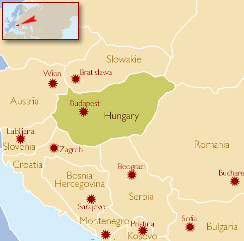
Hungary - brief overview about the Zenit destination Hungary.
Geopraphy
Slightly more than one half of Hungary's landscape consists of flat to rolling plains of the Pannonian Basin: the most important plain regions include the Little Hungarian Plain in the west, and the Great Hungarian Plain in the southeast. The highest elevation above sea level on the latter is only 183 metres.
Transdanubia is a primarily hilly region with a terrain varied by low mountains. These include the very eastern stretch of the Alps, Alpokalja, in the west of the country, the Transdanubian Medium Mountains, in the central region of Transdanubia, and the Mecsek Mountains and Villány Mountains in the south. The highest point of the area is the Írott-k? in the Alps, at 882 metres.
The highest mountains of the country are located in the Carpathians: these lie in the northern parts, in a wide band along the Slovakian border (highest point: the Kékes at 1,014 m/3,327 ft).
Hungary is divided in two by its main waterway, the Danube (Duna); other large rivers include the Tisza and Dráva, while Transdanubia contains Lake Balaton, a major body of water. The largest thermal lake in the world, Lake Hévíz (Hévíz Spa), is located in Hungary. The second largest lake in the Pannonian Basin is the artificial Lake Tisza (Tisza-tó).
Demographics
For 95% of the population, the mother language is Hungarian, a Finno-Ugric language unrelated to any neighbouring language and distantly related to Finnish and Estonian. The main Minority group are the Roma (2.1% - 10%). Other groups include: Germans (1.2%), Slovaks (0.4%), Croats and Bunjevcis(0.2%), Romanians (0.1%), Ukrainians (0.1%), and Serbs (0.1%).
For historical reasons (see Treaty of Trianon), significant Hungarian minority populations can be found in the surrounding countries, most of them in Romania (in Transylvania), Slovakia, Serbia (in Vojvodina). Sizable minorities live also in Ukraine (in Transcarpathia), Croatia (mainly Slavonia) and Austria (in Burgenland). Slovenia is also host to a number of ethnic Hungarians, and Hungarian language has an official status in parts of the Prekmurje region. Today, more than two million ethnic Hungarians live in nearby countries.
Economy
Hungary held its first multi-party elections in 1990, following four decades of Communist rule, and has succeeded in transforming its centrally planned economy into a market economy. Both foreign ownership of and foreign investment in Hungarian firms are widespread. The governing coalition, comprising the Hungarian Socialist Party and the liberal Alliance of Free Democrats, prevailed in the April 2006 general election. Hungary needs to reduce government spending and further reform its economy in order to meet the 2012–2013 target date for accession to the euro zone.
Hungary has continued to demonstrate economic growth as one of the newest member countries of the European Union (since 2004). The private sector accounts for over 80% of GDP. Hungary gets nearly one third of all foreign direct investment flowing into Central Europe, with cumulative foreign direct investment totaling more than US$185 billion since 1989. It enjoys strong trade, fiscal, monetary, investment, business, and labor freedoms. The top income tax rate is fairly high, but corporate taxes are low. Inflation is low, it was on the rise in the past few years, but it is now starting to regulate. Investment in Hungary is easy, although it is subject to government licensing in security-sensitive areas. Foreign capital enjoys virtually the same protections and privileges as domestic capital. The rule of law is strong, a professional judiciary protects property rights, and the level of corruption is low.
The Hungarian economy is a medium-sized, structurally, politically, and institutionally open economy in Central Europe and is part of the EU single market. Like most Eastern European economies, it experienced market liberalisation in the early 1990s as part of a transition away from communism. Today, Hungary is a full member of OECD and the World Trade Organization. OECD was the first international organization to accept Hungary as a full member in 1996, after six years of successful cooperation.
Climate
Hungary has a Continental climate, with hot summers with low overall humidity levels but frequent rainshowers and frigid to cold snowy winters. Average annual temperature is 9.7 °C (49.5 °F). Temperature extremes are about 42 °C (107.6 °F) in the summer and −29 °C (−20.2 °F) in the winter. Average temperature in the summer is 27 °C (80.6 °F) to 35 °C (95 °F) and in the winter it is 0 °C (32 °F) to −15 °C (5.0 °F). The average yearly rainfall is approximately 600 mm (23.6 in). A small, southern region of the country near Pécs enjoys a reputation for a Mediterranean climate, but in reality it is only slightly warmer than the rest of the country and still receives snow during the winter.
Infrastructure
Republic of Hungary is located in the central part of the Pannonian Vale, and is a landlocked country, which is conducive to the development of all forms of traffic.
Hungary has developed road, railway, air and water traffic. Budapest, the capital of the state, to the measures is an important node in the public transport network, to say that "all roads lead to Budapest".
Motorways (Hungarian: Autópálya):
M0 - M1 - M2 - M15 - M3 - M30 - M35 - M5 - M6 - M7 - M70
Total: 188,490 km
Paved: 81,950 km (including 1013 km of motorways, 2007)
Unpaved: 106,523 km (1998 est.) New motorway sections are being added to the existing network, that already connects many major economically important cities to the Capital City.
More Information: http://en.wikipedia.org/wiki/Hungary
Text is available under the Creative Commons Attribution-ShareAlike License; additional terms may apply. See Terms of Use for details.
Wikipedia® is a registered trademark of the Wikimedia Foundation, Inc., a non-profit organization.